By Ibrahim Sesay
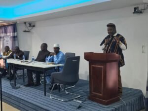
The newly appointed Chief Electoral Commissioner and Chairman of the Electoral Commission for Sierra Leone (ECSL), Edmond Sylvester Alpha, has set a reform-focused tone for the country’s democratic future, calling for unity, transparency, and sustained inter-party dialogue as Sierra Leone begins early preparations for the 2028 General Elections.
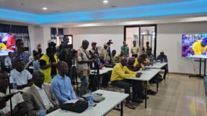
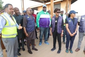
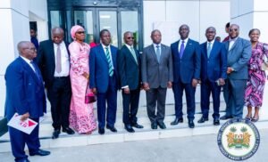
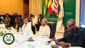
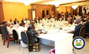
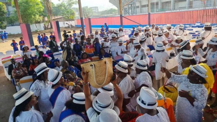
Speaking during a high-level consultative engagement with registered political parties at the ECSL headquarters in Freetown on Wednesday, 1st April 2026, Chairman Alpha emphasized that the credibility of the 2028 multi-tier elections will depend on the collective willingness of all political actors to work together in good faith. The event, which served as his formal introduction to political parties following his appointment, brought together party representatives, commissioners, the media, and key democratic governance stakeholders, although the APC and C4C were notably absent.
In his keynote address, Edmond Sylvester Alpha described the meeting as a defining moment in Sierra Leone’s democratic journey, stressing that dialogue remains the bedrock upon which enduring democratic trust is built.
He reflected on Sierra Leone’s democratic progress over the past two decades, citing the institutional reforms of 2005 and the successful conduct of elections in 2007, 2012, 2018, and 2023 as evidence of the country’s resilience, political maturity, and commitment to democratic governance.
According to him, these democratic gains belong not to any single institution or political party but to the people of Sierra Leone, making it the collective responsibility of all stakeholders to protect and deepen them.
Chairman Alpha acknowledged that recent political developments, especially in the aftermath of the 2023 elections, have generated tensions and concerns among stakeholders. However, he assured political parties and the public that his leadership would focus on restoring confidence, strengthening understanding, and creating platforms for inclusive participation.
He reiterated that the Electoral Commission exists to serve all Sierra Leoneans equally and must remain impartial in carrying out its constitutional mandate.
“The Commission is not aligned to any political interest. It does not determine political outcomes. Its role is to provide a credible, transparent, and accountable process through which the will of the people is freely expressed,” he stated.
He emphasized that while voters determine electoral outcomes, the responsibility of the Commission is to ensure that the process through which those outcomes emerge remains trusted, lawful, and transparent.
In what many observers viewed as an olive branch to skeptical political actors, the ECSL Chairman openly acknowledged that the concerns raised by political parties and other stakeholders are valid contributions toward strengthening the country’s electoral system.
He noted that electoral integrity must be viewed as a continuous process that goes beyond polling day itself. According to him, it encompasses the full electoral cycle, including legal frameworks, operational preparedness, stakeholder trust, civic education, dispute resolution, inclusion, and transparency in public communication.
Drawing attention to the reform-oriented recommendations emerging from the national Tripartite engagement process, Alpha said the current moment presents an important opportunity for collective institutional improvement rather than division.
He identified key reform priorities as strengthening transparency in electoral operations and results management, improving stakeholder consultation and inclusive dialogue mechanisms, clarifying legal and procedural guidelines, enhancing public communication, and building confidence among political actors and institutions.
With less than two years before the 2028 elections, Chairman Alpha warned that Sierra Leone has a narrow but critical window to undertake essential preparatory processes.
He listed boundary delimitation, voter registration, electoral planning, and nationwide civic education as urgent processes that must commence in earnest and be carried out in a manner trusted by all stakeholders.
To give practical effect to this collaborative vision, the ECSL Chairman proposed a roadmap anchored on structured engagement and institutional cooperation.
Among the measures he outlined were the reinforcement of the Political Parties Liaison Committee (PPLC), the establishment of a standing Inter-Party Dialogue and Consultation Forum convened regularly by the Commission, the creation of joint technical working groups with party representatives, and the development of a shared electoral roadmap leading to 2028.
He also proposed stronger communication channels to ensure timely, accurate, and transparent information flow to all registered political parties.
“Our democracy is strongest not when we agree on everything, but when we remain committed to working together despite our differences,” Alpha said, adding that Sierra Leoneans are looking to democratic leaders for unity of purpose and responsible leadership.
The consultative meeting also featured strong interventions from other electoral stakeholders.
Welcoming attendees, ECSL Executive Secretary William Addo Davies said the purpose of the meeting was to formally introduce the new Chief Electoral Commissioner and Chairman while reaffirming the institution’s commitment to continuous dialogue with stakeholders in the electoral process.
The All Political Parties Association (APPA), through its National Secretary General Ibrahim Sorie Sesay, also presented a detailed statement outlining expectations from the new ECSL leadership.
APPA called for the immediate reactivation of the Political Parties Liaison Committee, describing it as critical for structured dialogue and consensus-building. The association also urged the Commission to ensure that all registered political parties are fully included in ongoing reform discussions, especially those linked to the Tripartite process.
The association further called for stronger transparency and accountability in election date communication, polling procedures, and results management, while also advocating for a comprehensive review of the Proportional Representation system to make it more equitable and representative.
Additionally, APPA stressed the need for stronger operational readiness, timely strategic planning, reinforced monitoring and enforcement mechanisms, improved voter registration integrity, expanded voter education, and the deployment of secure and reliable electoral technology.
“Trust is the currency of credible elections. It is earned through fairness, openness, and accountability,” Ibrahim Sorie Sesay stated.
Other speakers, including representatives of the Political Parties Regulation Commission, reinforced the need for cooperation, equality among political parties, and early preparations for the 2028 elections.
The meeting ended with renewed optimism, as commissioners and political stakeholders pledged to work collectively toward delivering elections that are free, fair, peaceful, transparent, and widely accepted.
As Sierra Leone continues to address post-2023 electoral tensions, the ECSL’s renewed emphasis on inclusivity, reform, and trust-building under Edmond Sylvester Alpha’s leadership could prove pivotal in shaping a more credible and collectively owned electoral process in 2028.


, Edmond Sylvester Alpha")